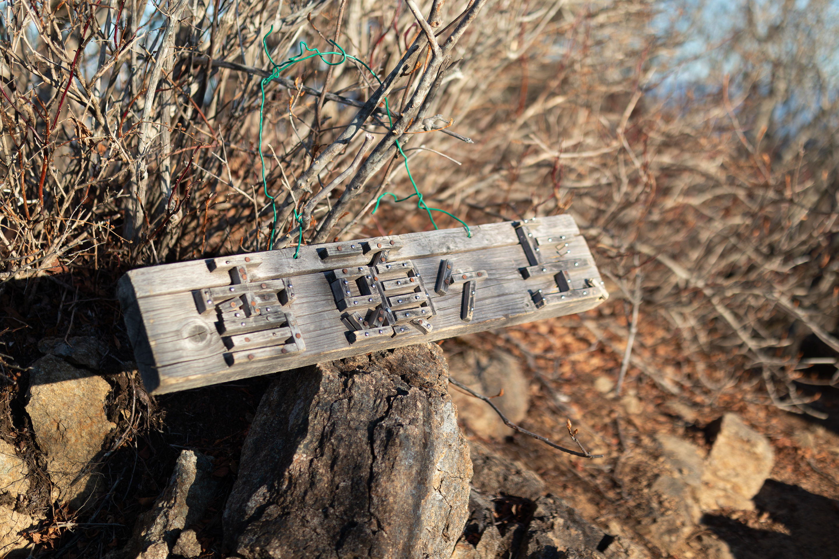
Mt. Settogatake 雪頭ヶ岳 • Mt. Settogatake 節刀ヶ岳 • Mt. Junigatake 十二ヶ岳
2024-12-24
Location: Yamanashi Prefecture
Date Captured: 2024-12-24
Date Published: 2025-09-11
Last Modified: 2025-09-12
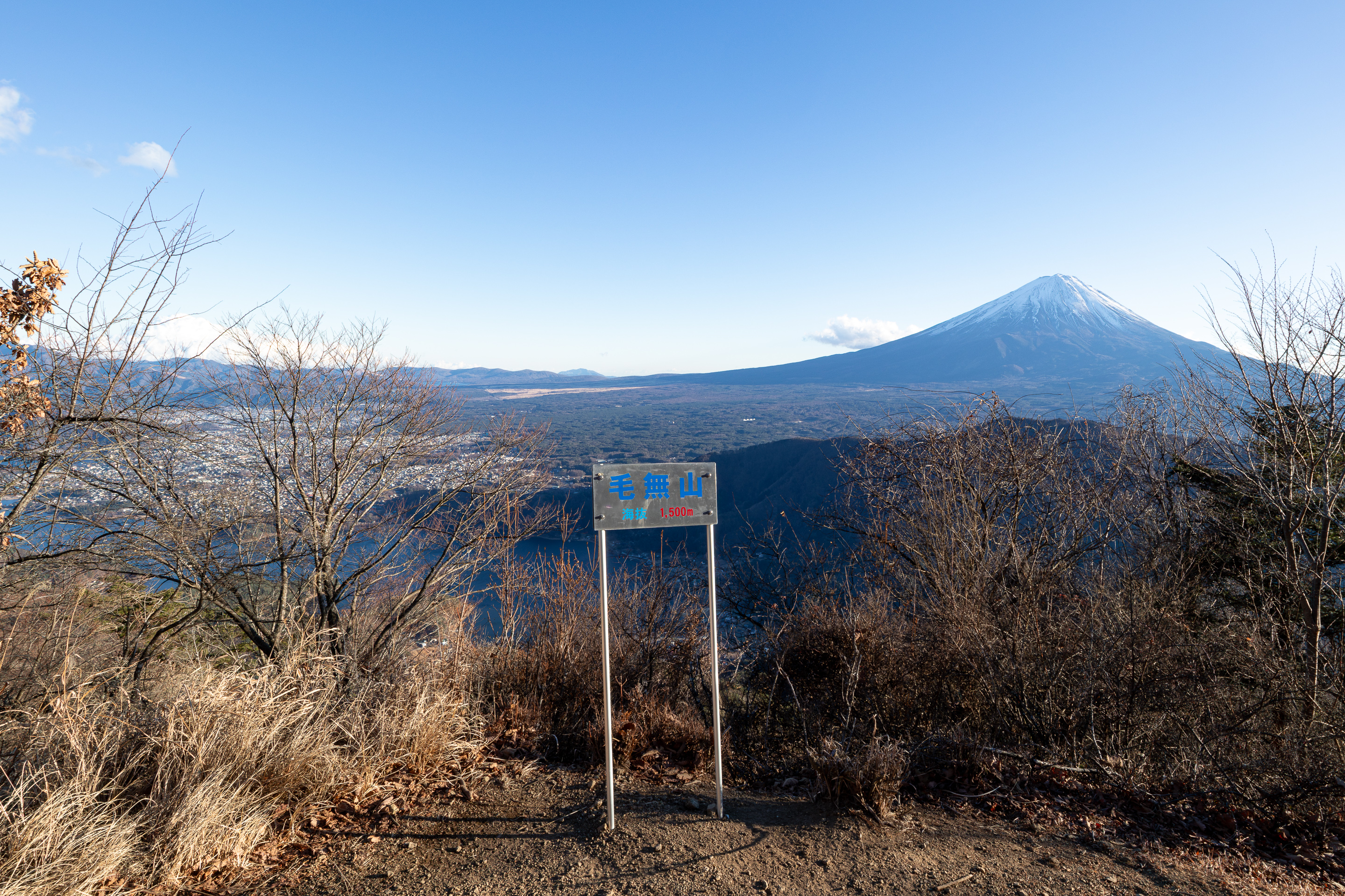
Hiking route: Kawaguchiko Station 河口湖駅 -> Saiko Nenbahama Parking Lot 西湖根場浜駐車場 -> Mt. Settogatake 雪頭ヶ岳 -> Mt. Onigatake 鬼ヶ岳 -> Mt. Settogatake 節刀ヶ岳 -> Mt. Junigatake 十二ヶ岳 -> Mt. Kenashi 毛無山 -> Oishi Park 大石公園 -> Kawaguchiko Station 河口湖駅.
Not sure when I got the idea that walking 2-3 hours from the station to the trailhead was a completely normal thing to do, because I did it again without a second thought. This time I even went full-gear: a tripod, four lenses plus accessories, in addition to the normal hiking stuff. You bet life decisions were questioned repeatedly throughout this 22-hour hike.
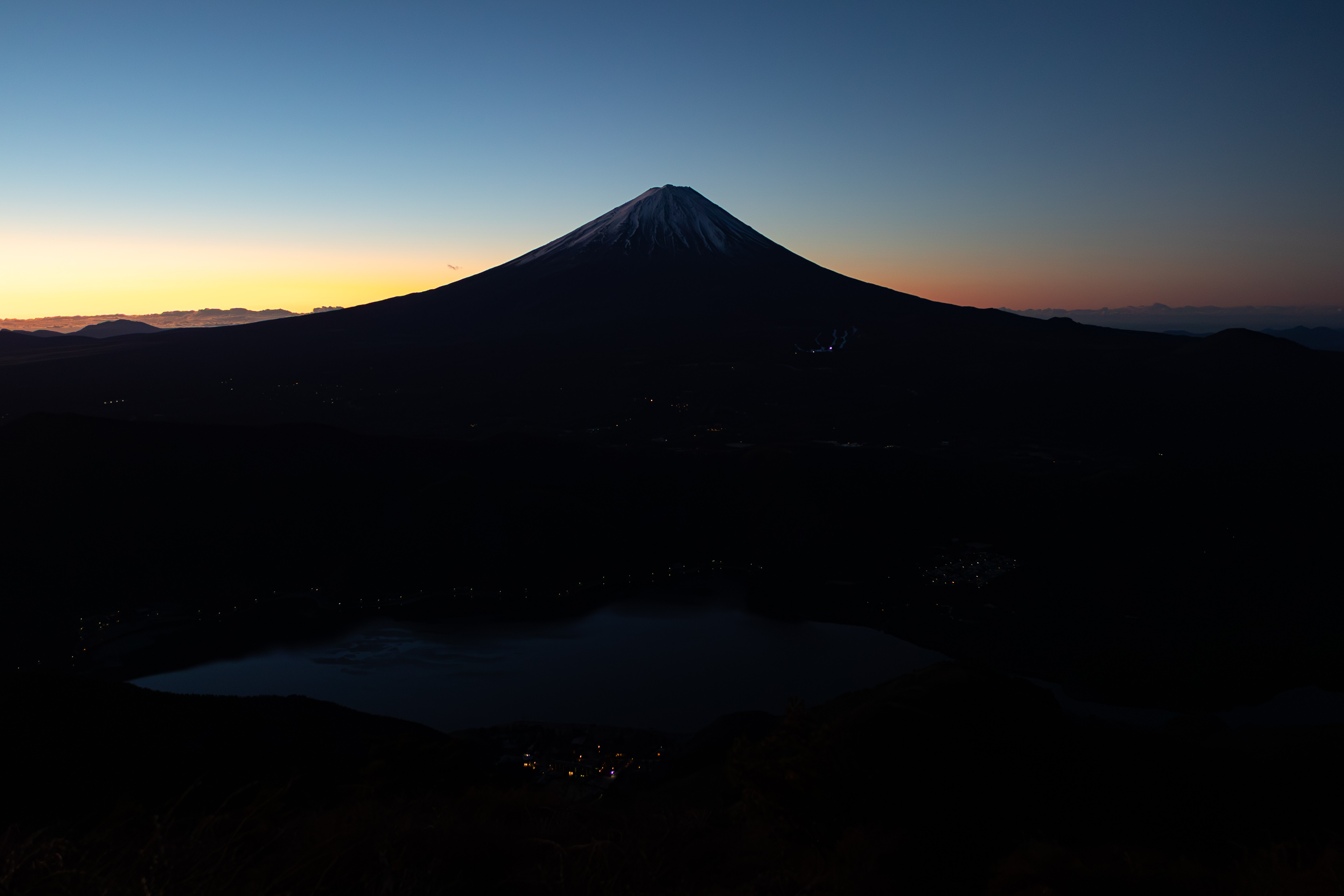
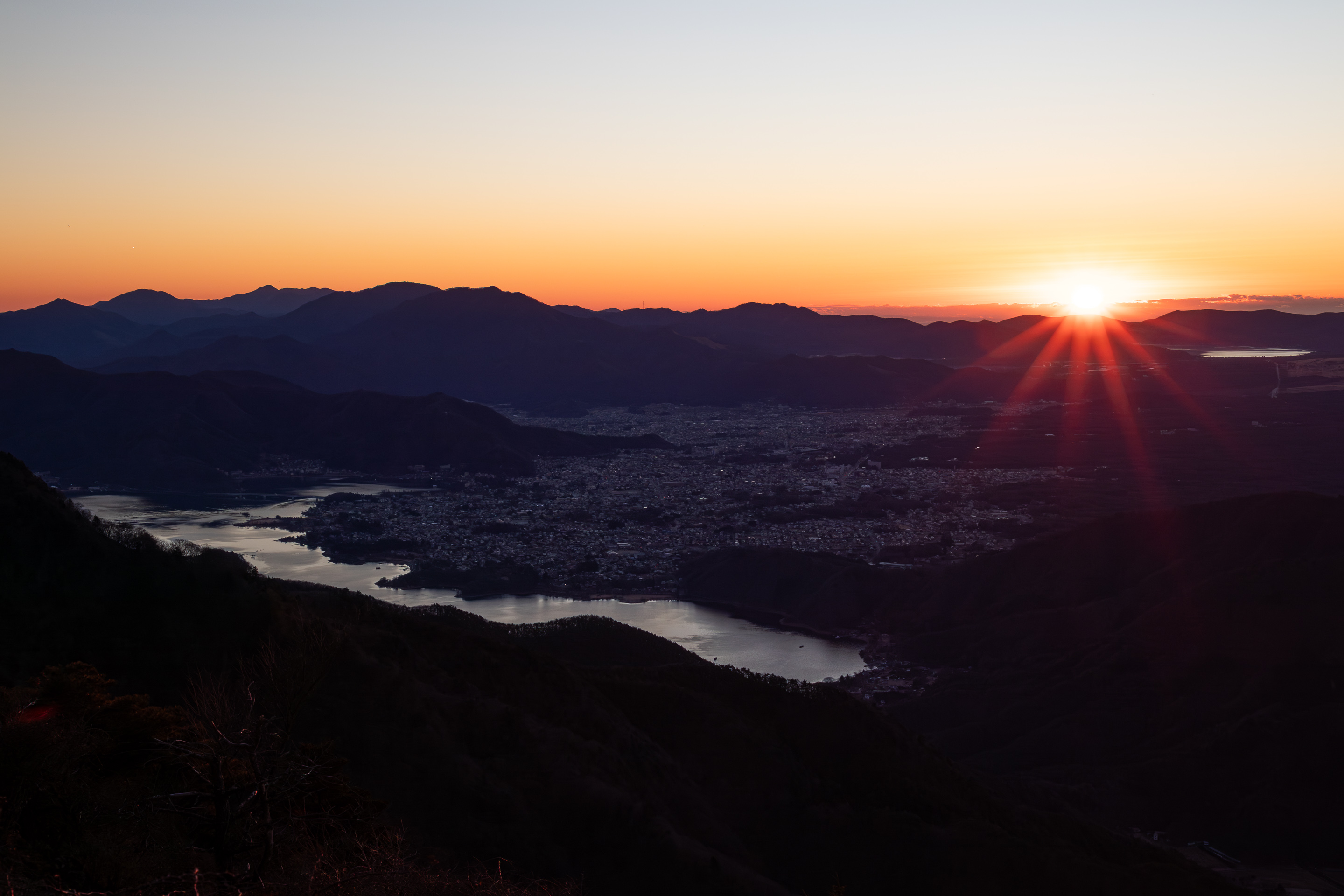
The original goal was to capture a timelapse of the sunrise on Mt. Settogatake 雪頭ヶ岳 (my first time timelapsing anything). While researching the route, I noticed another Settogatake 節刀ヶ岳 nearby with the same reading but different spelling, so I decided to add it to the itinerary for giggles. Then of course I needed a return route, and Mt. Junigatake looked most suitable distance-wise.
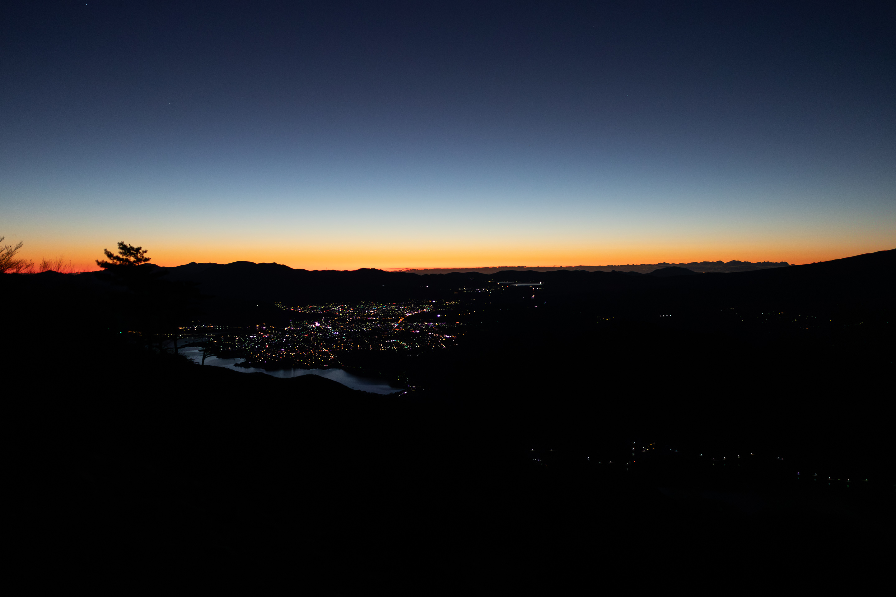
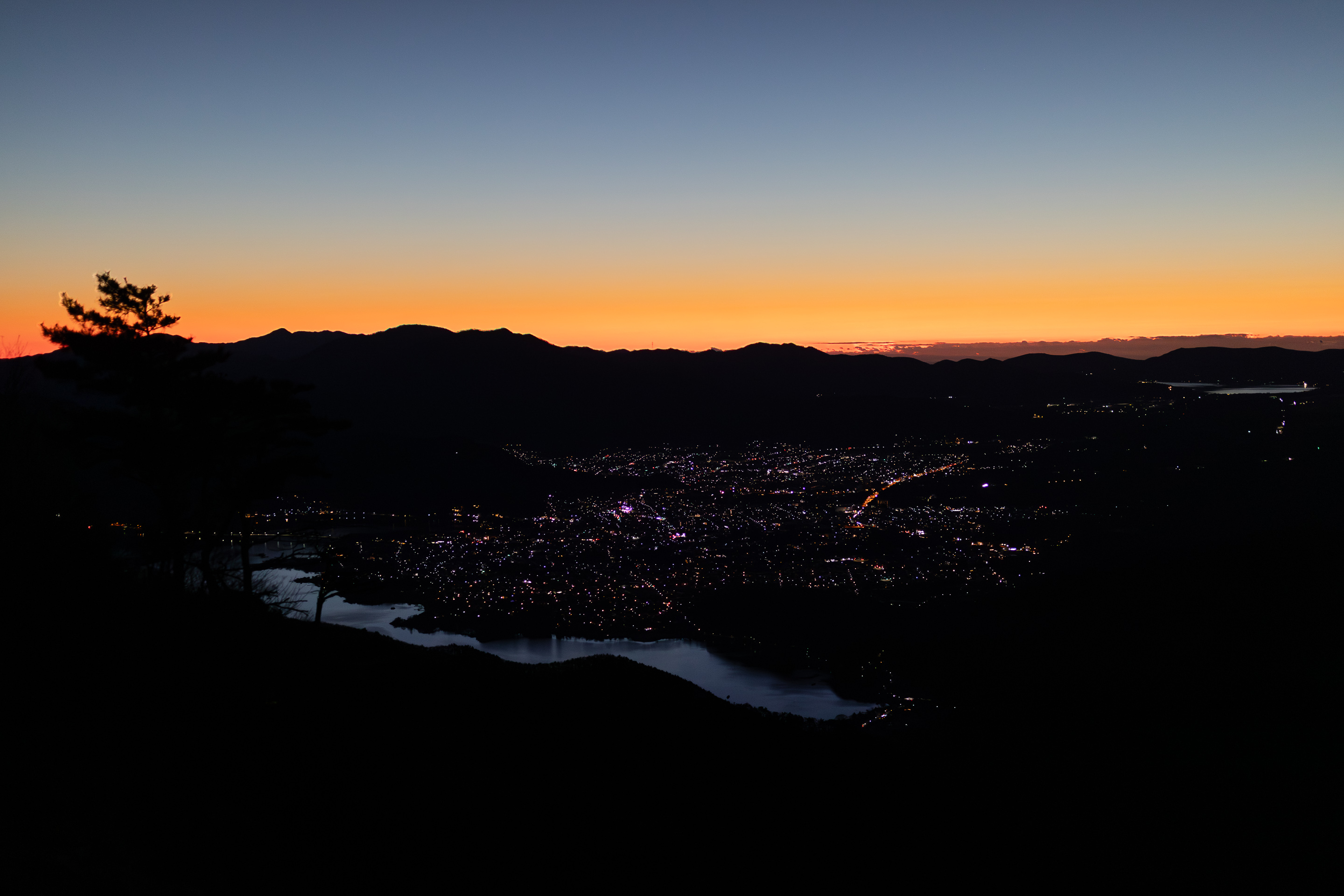
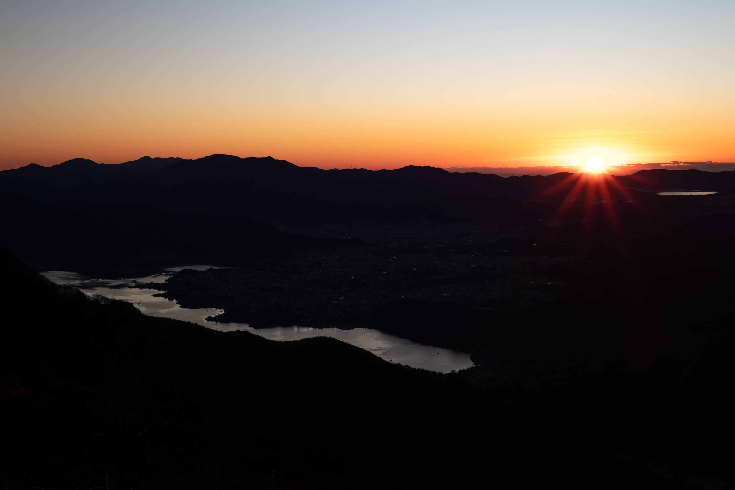
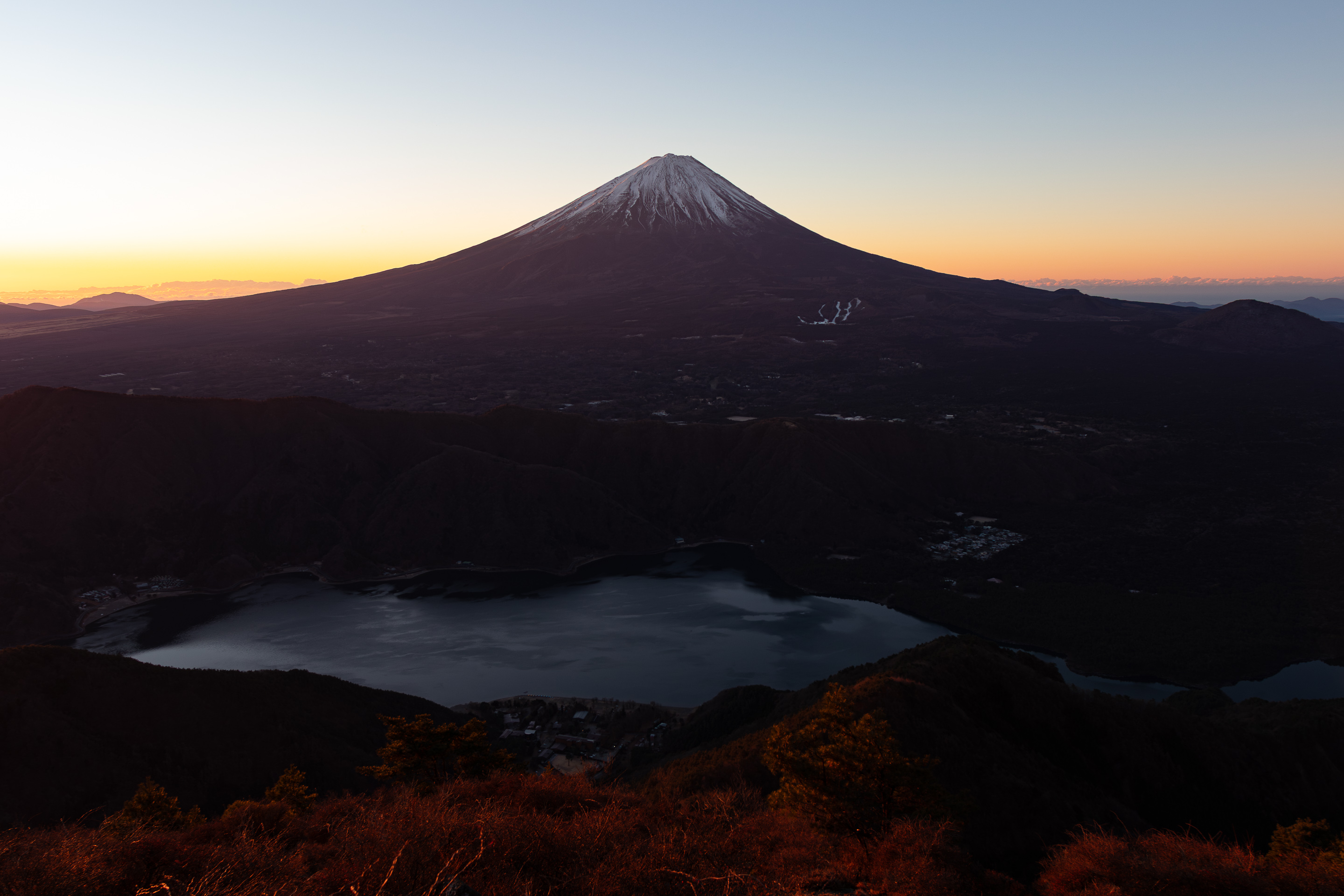
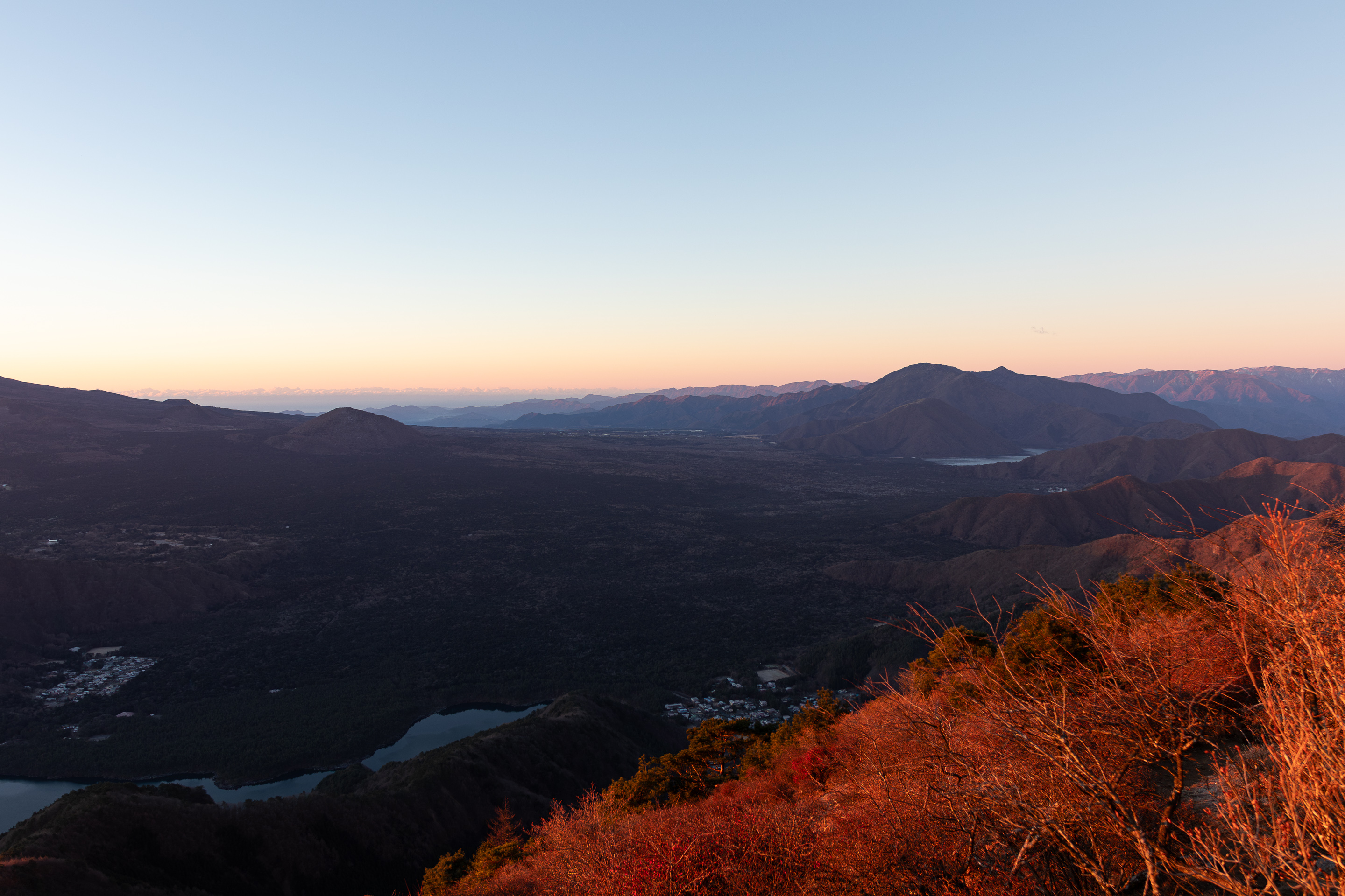
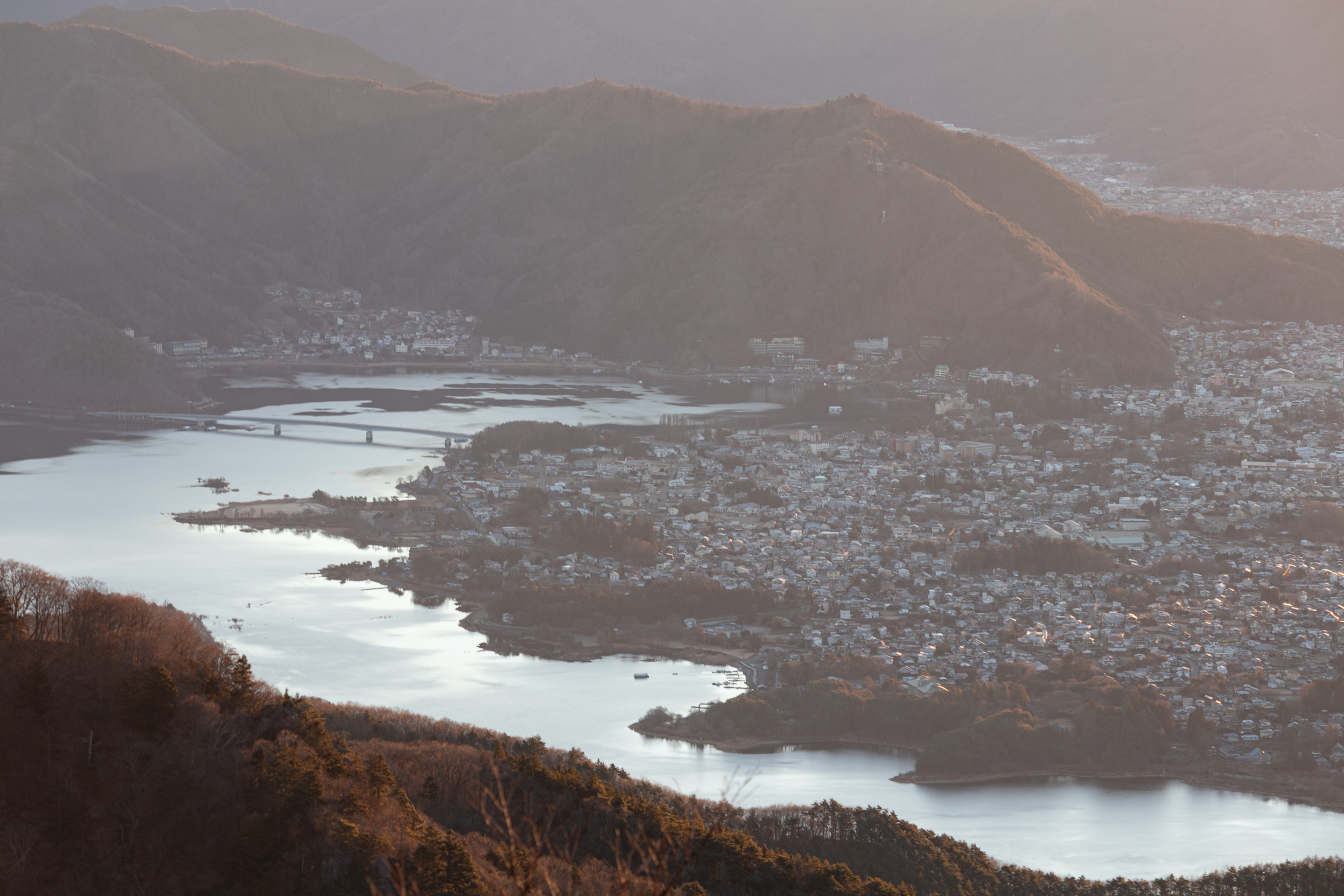
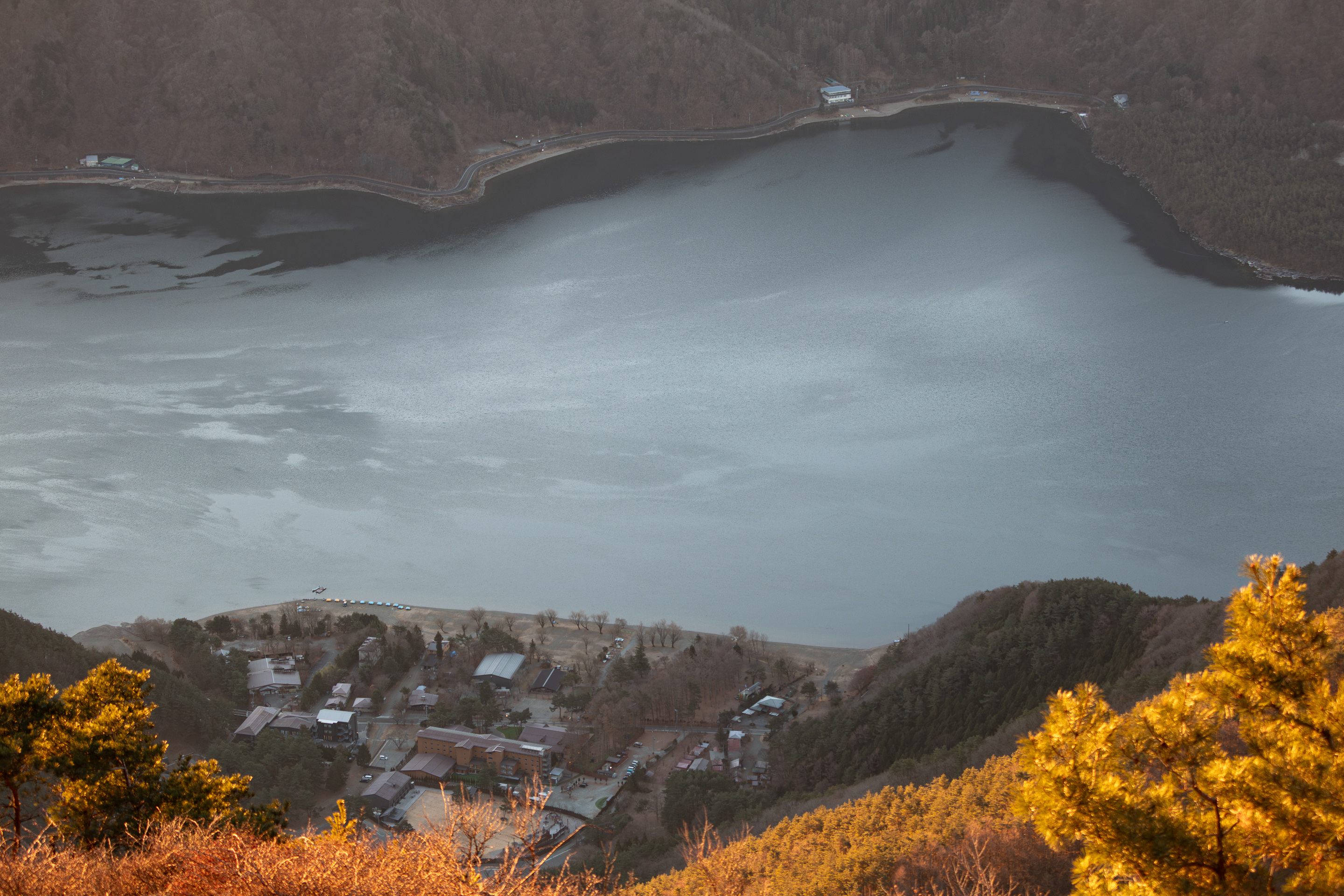
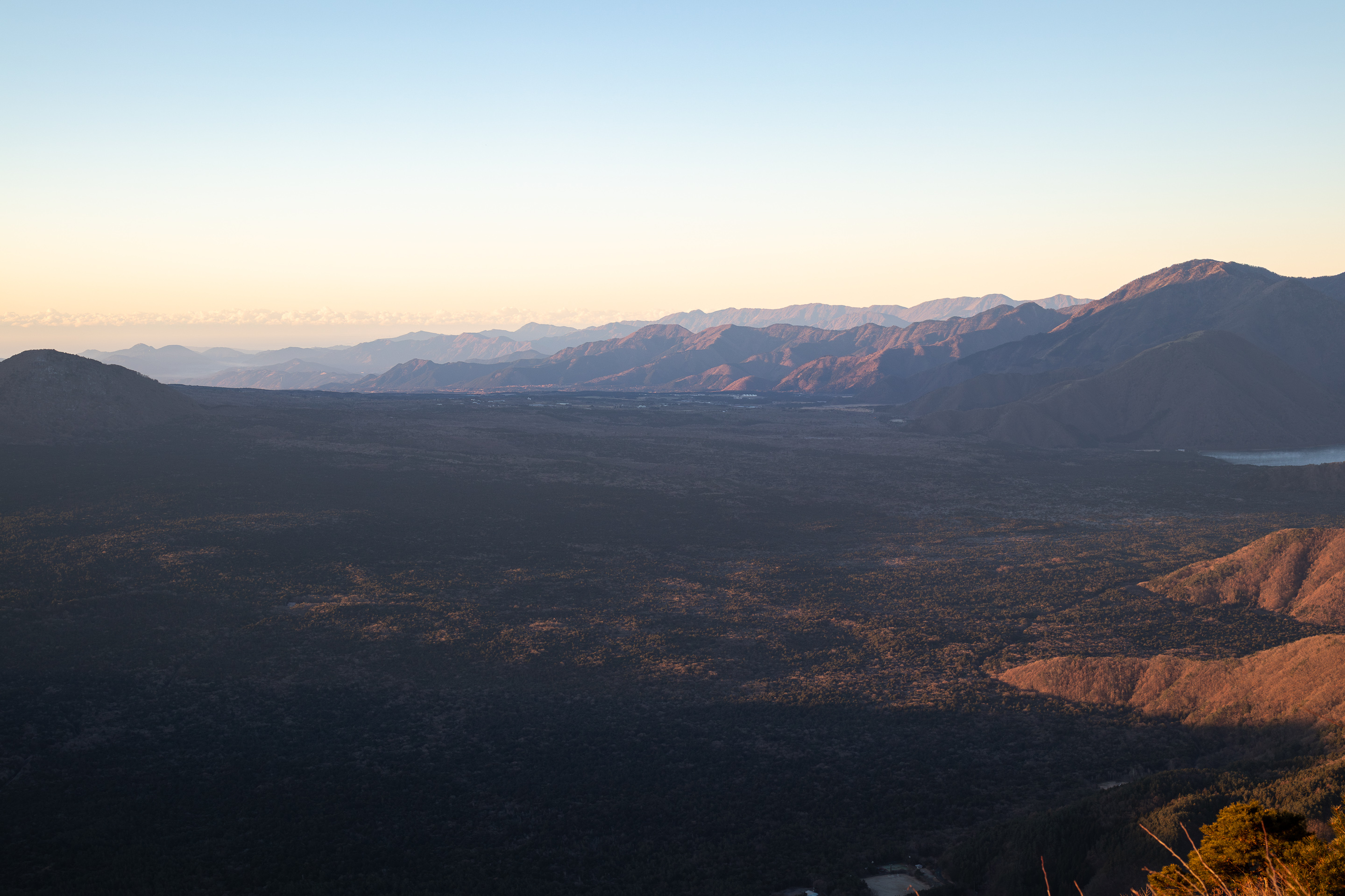
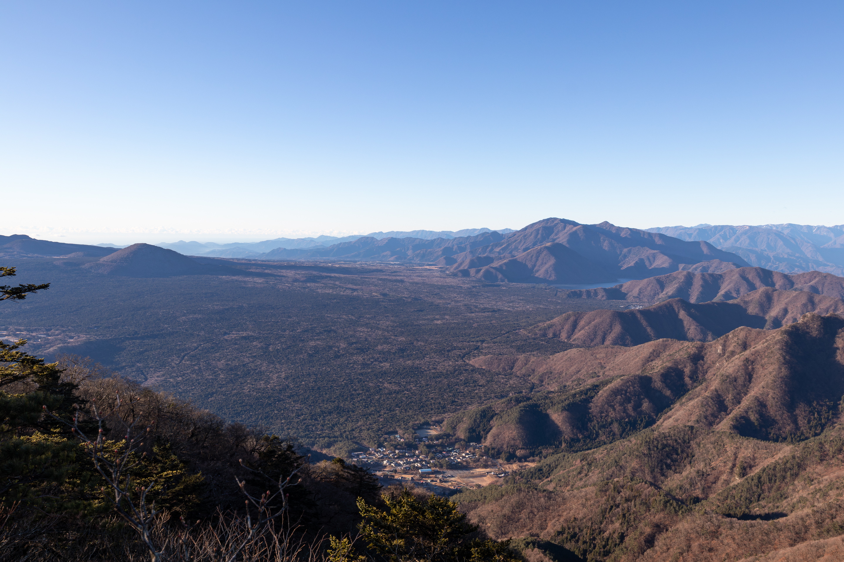
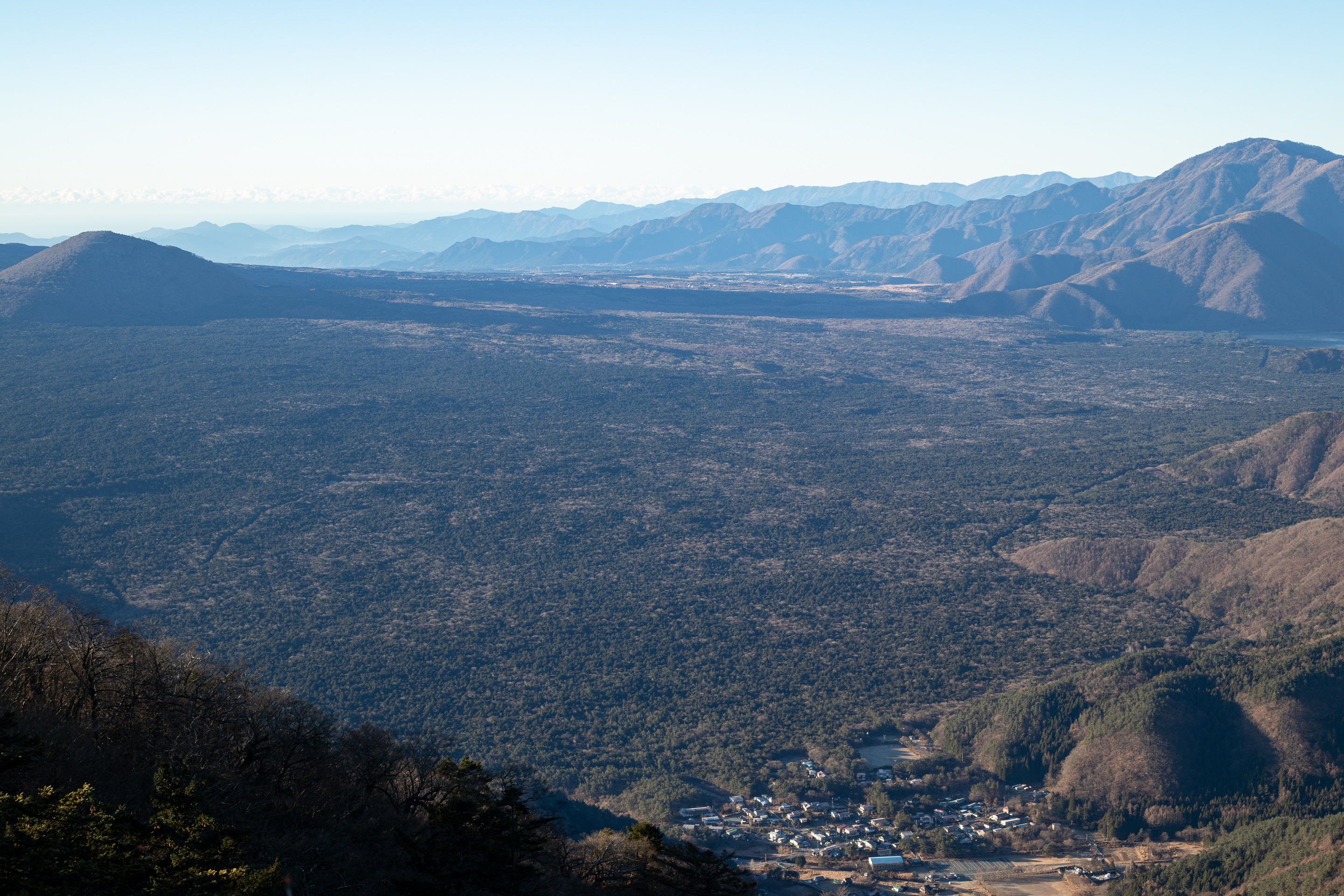
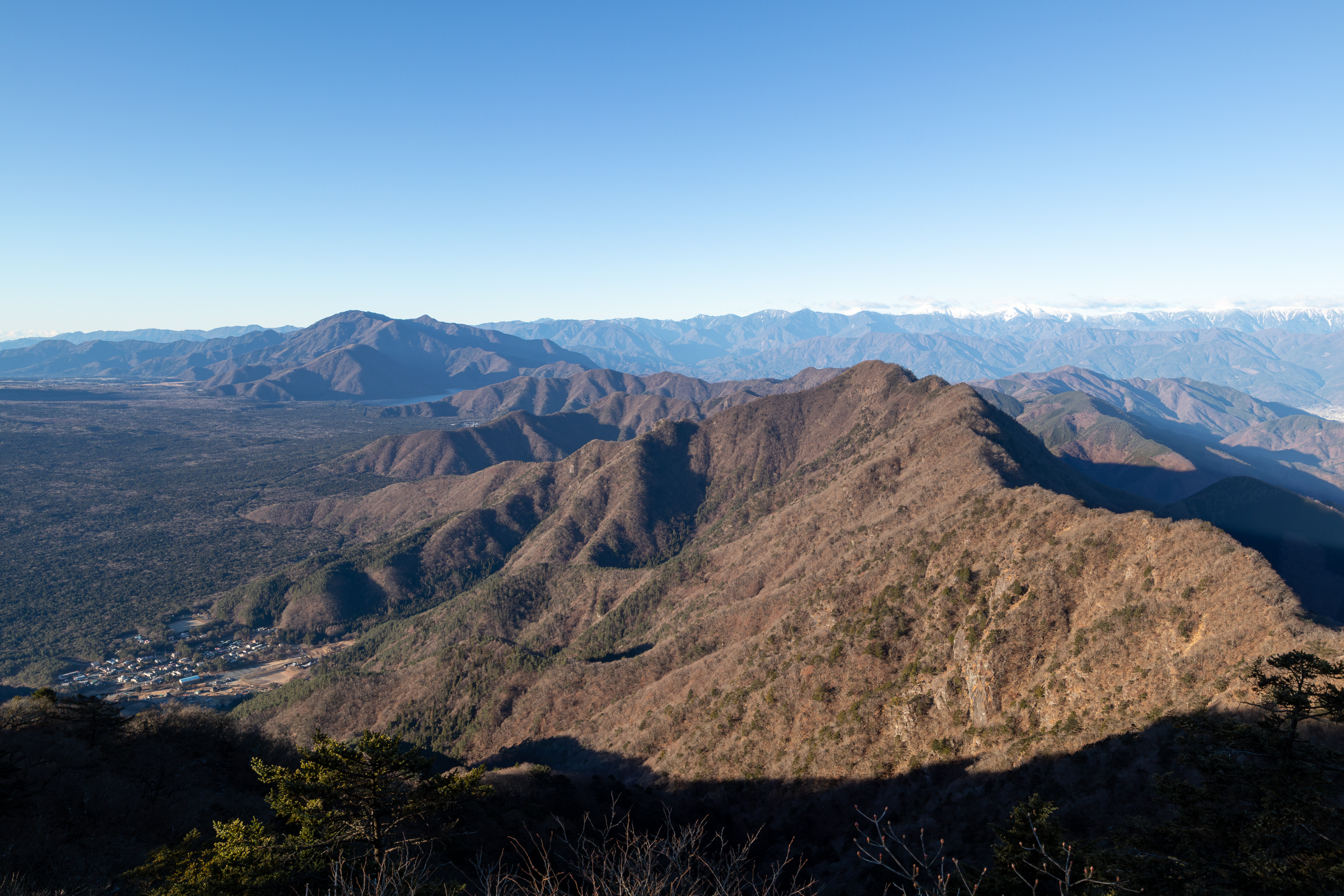
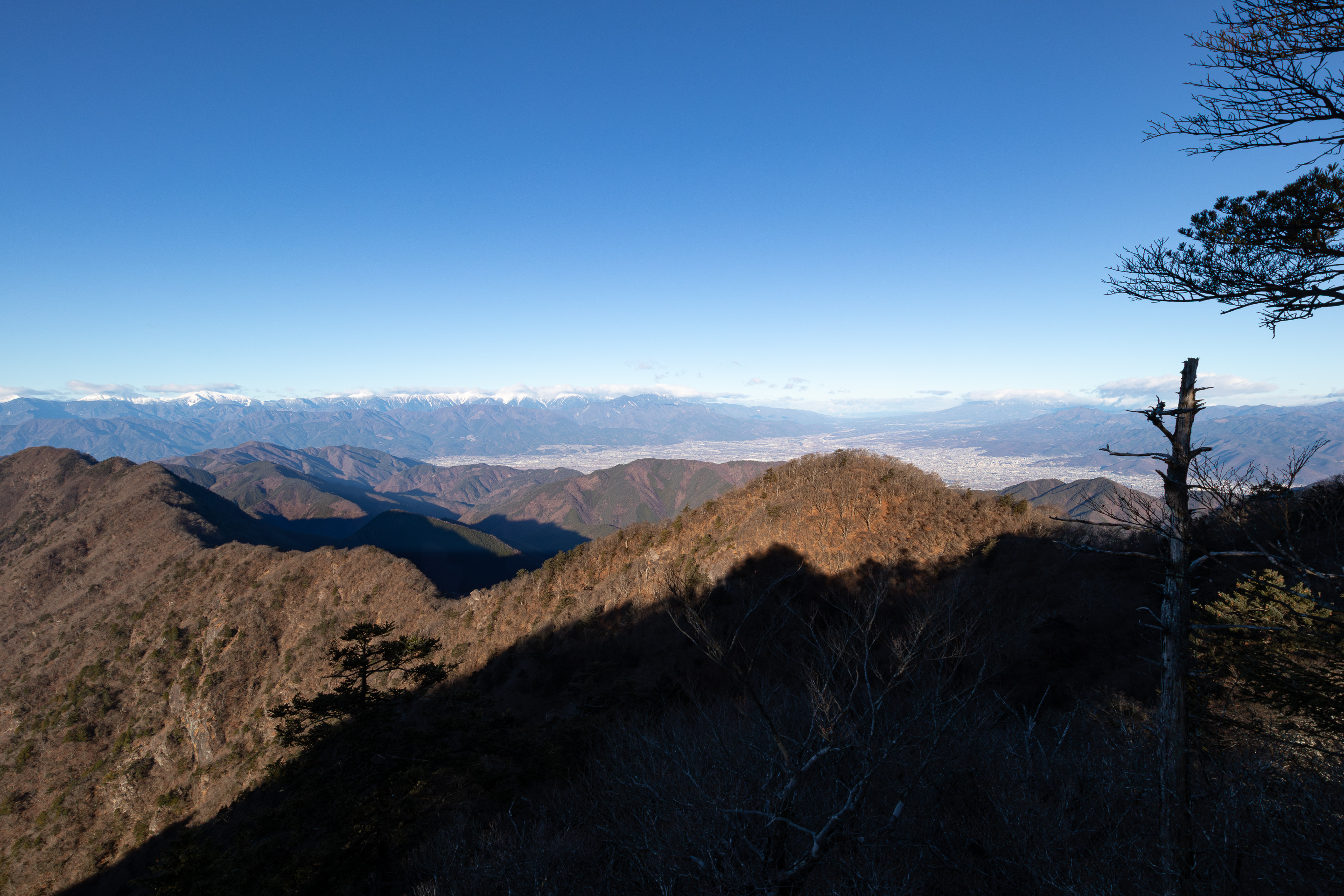
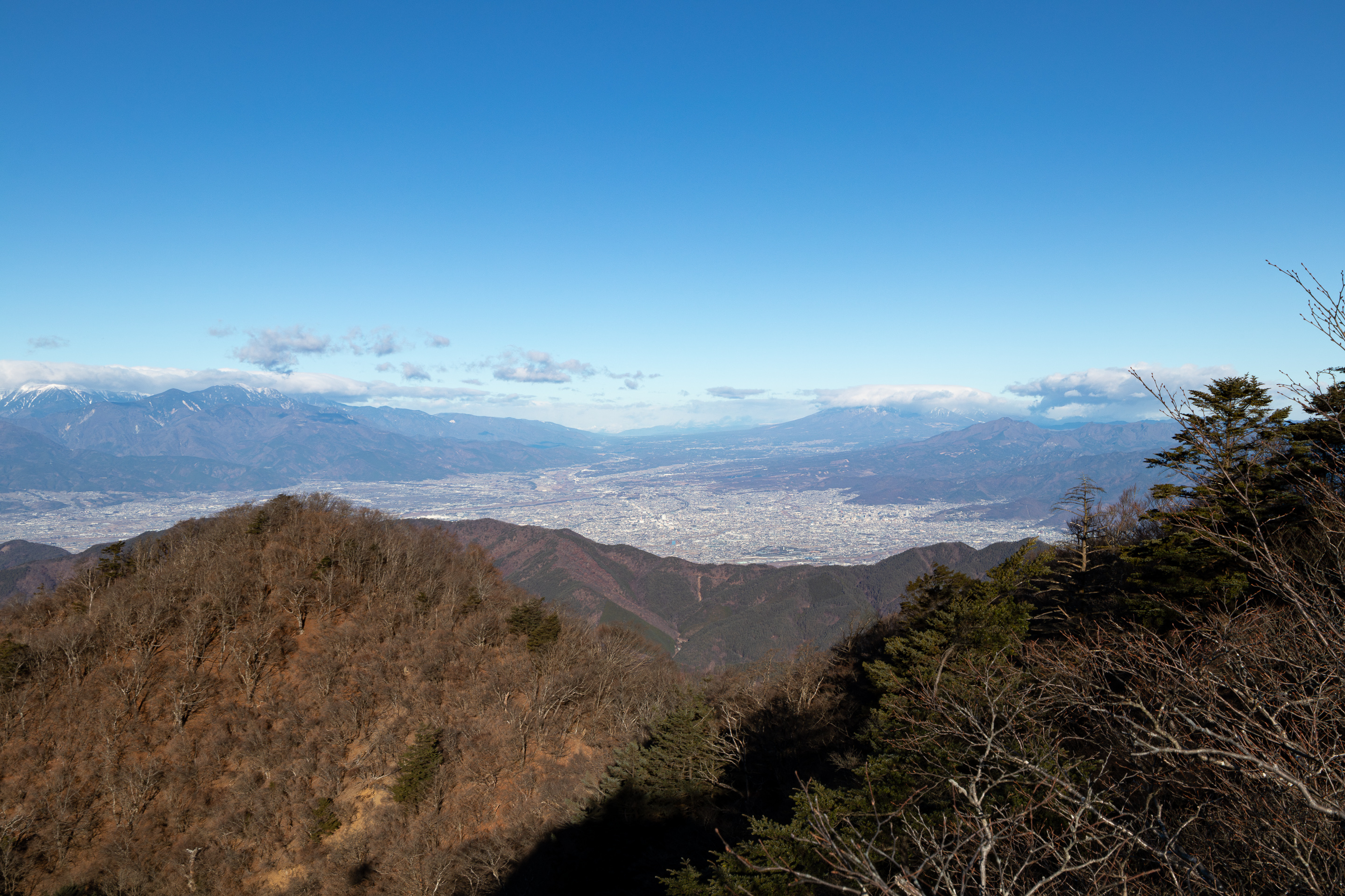
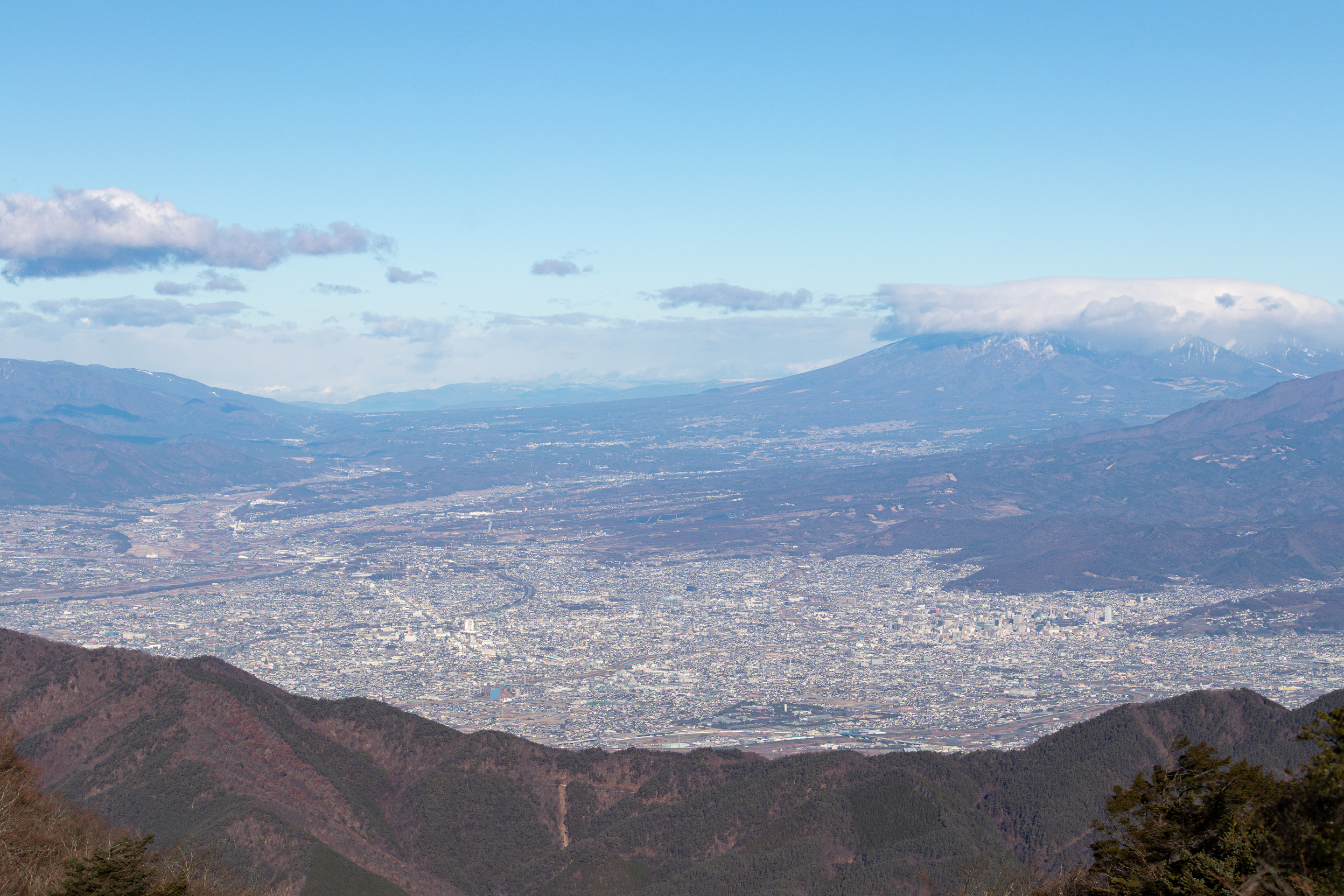
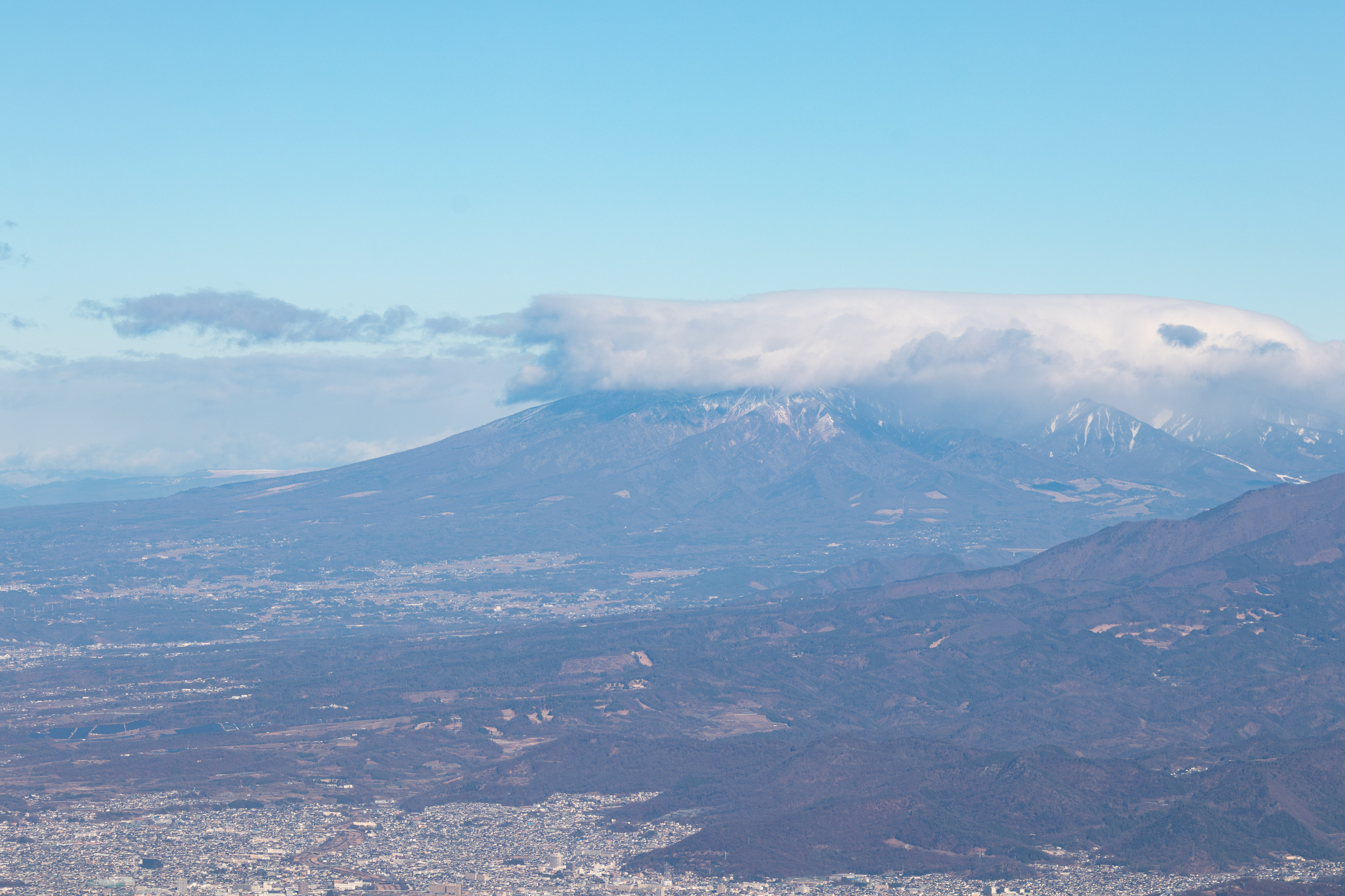
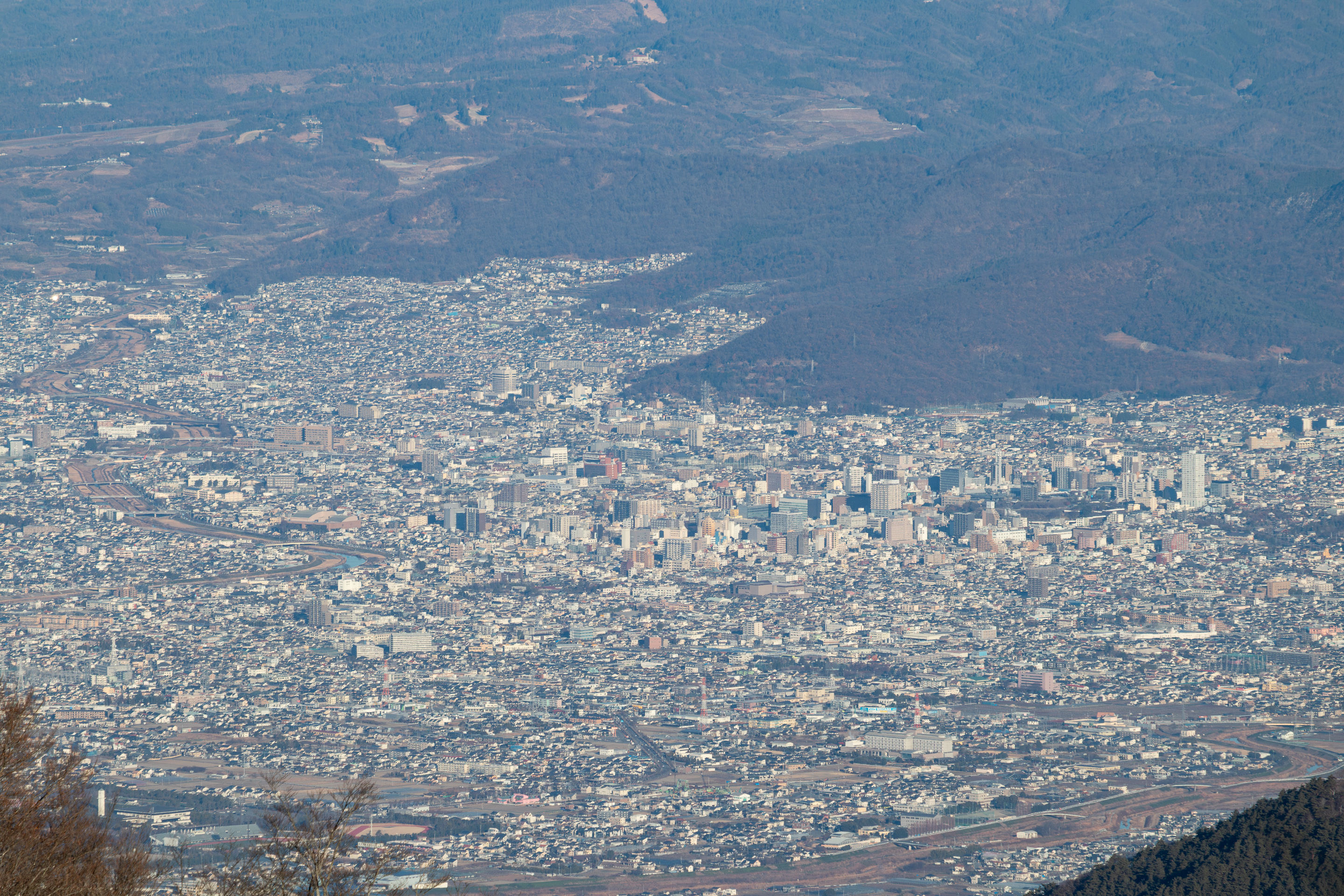
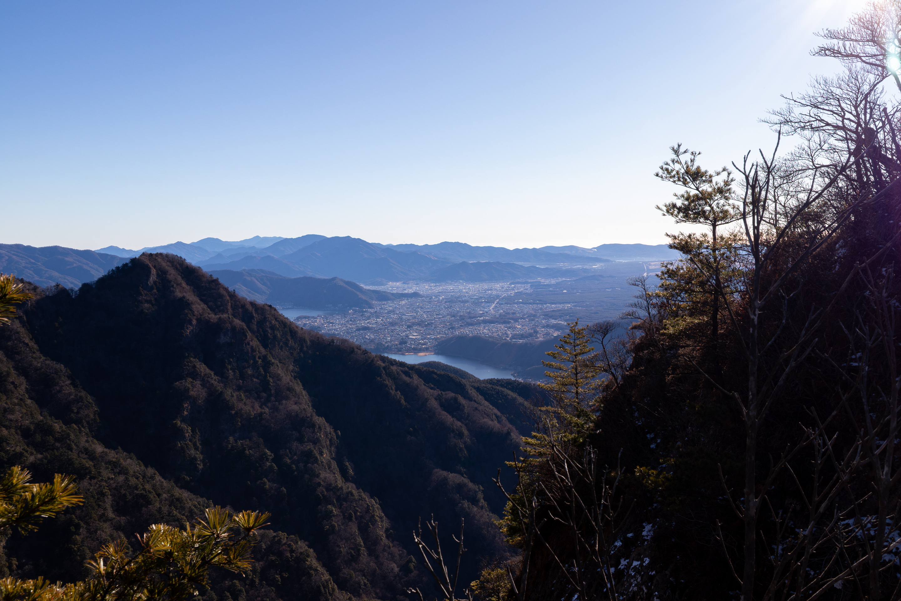
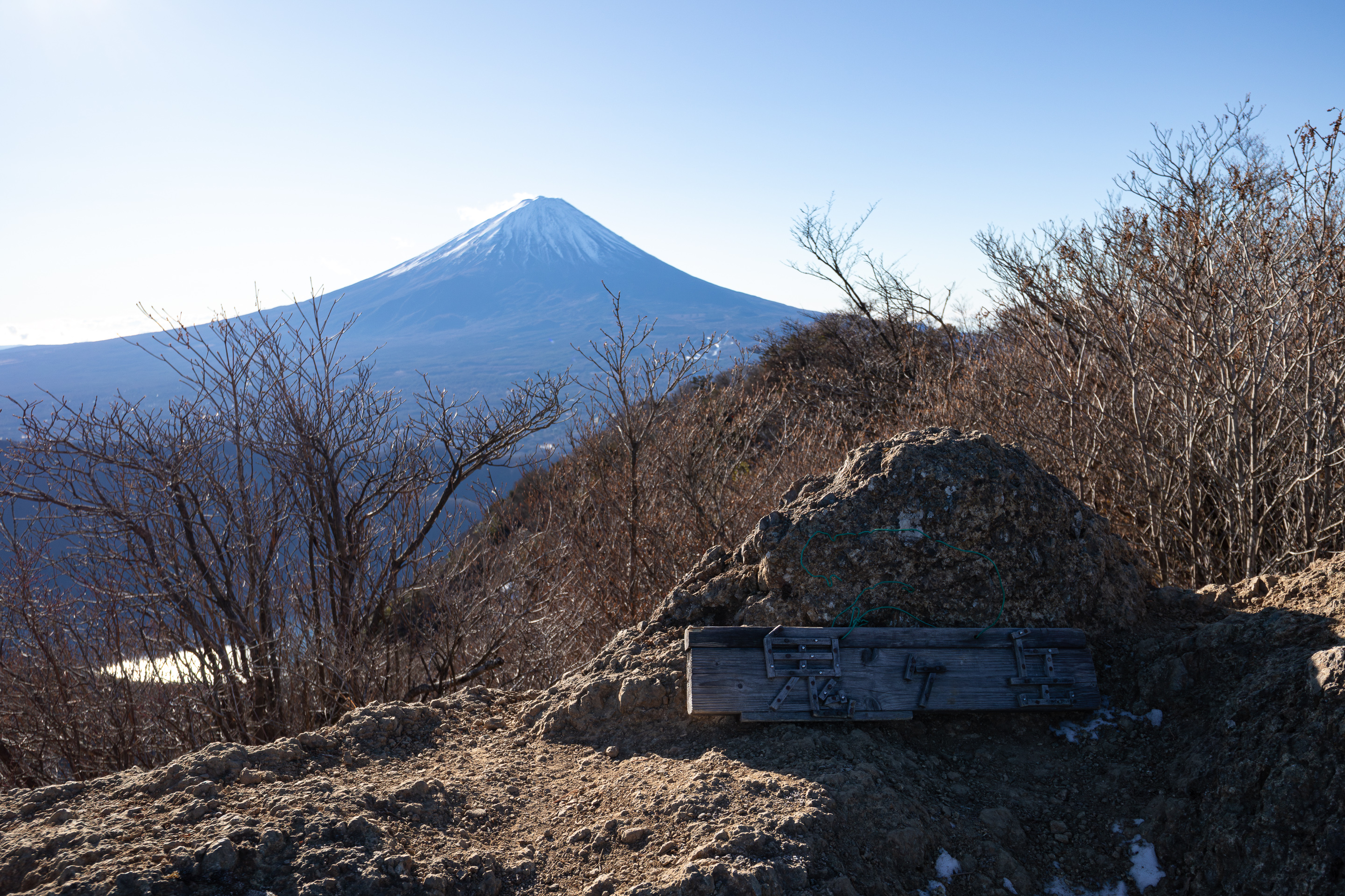
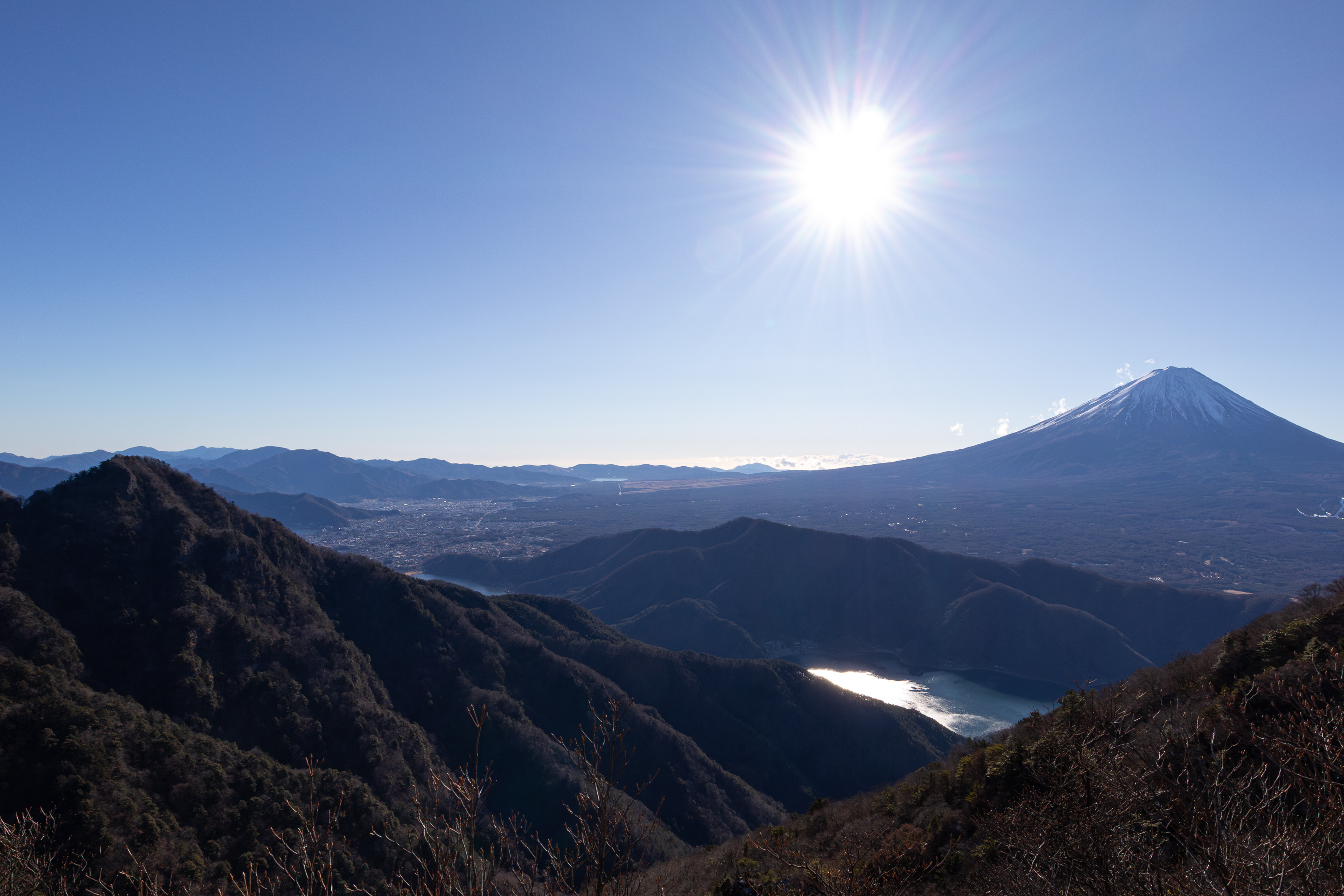
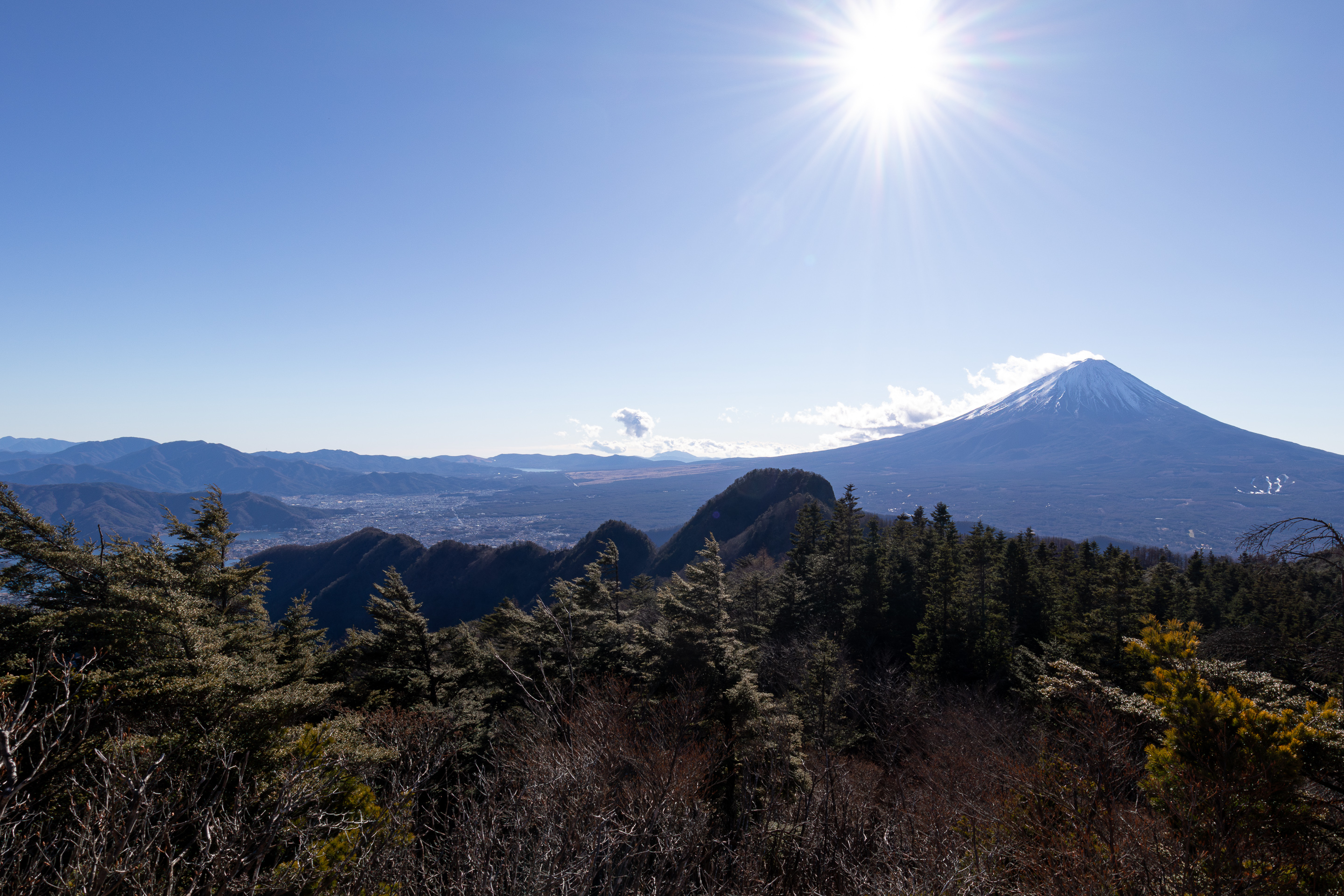
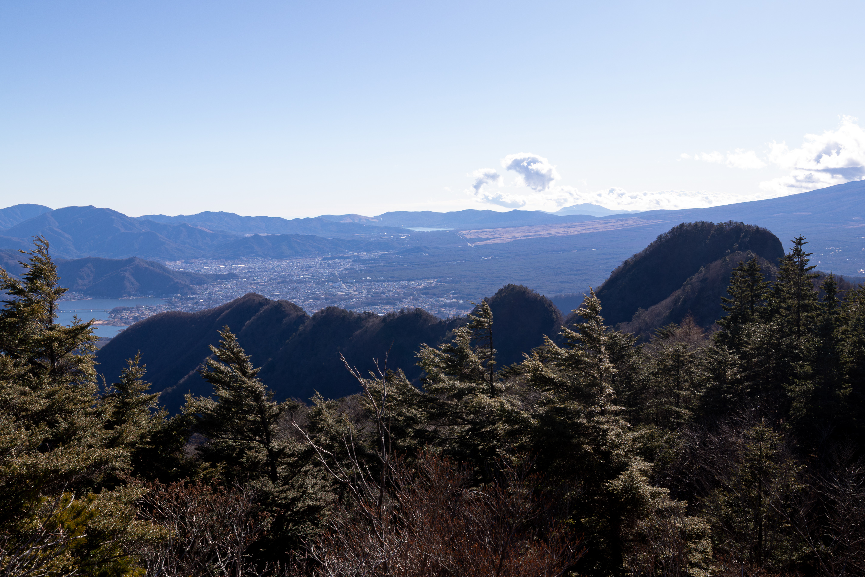
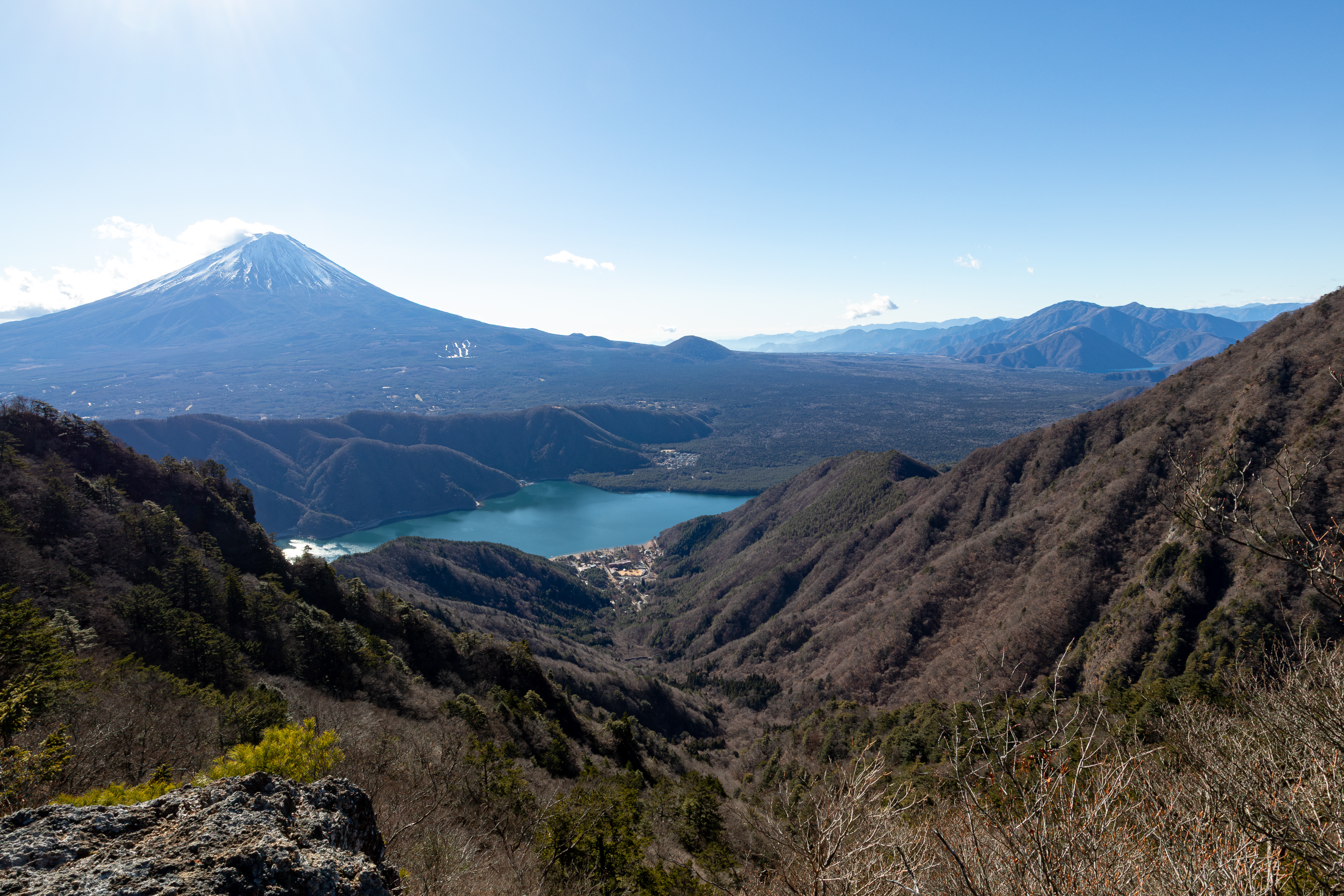
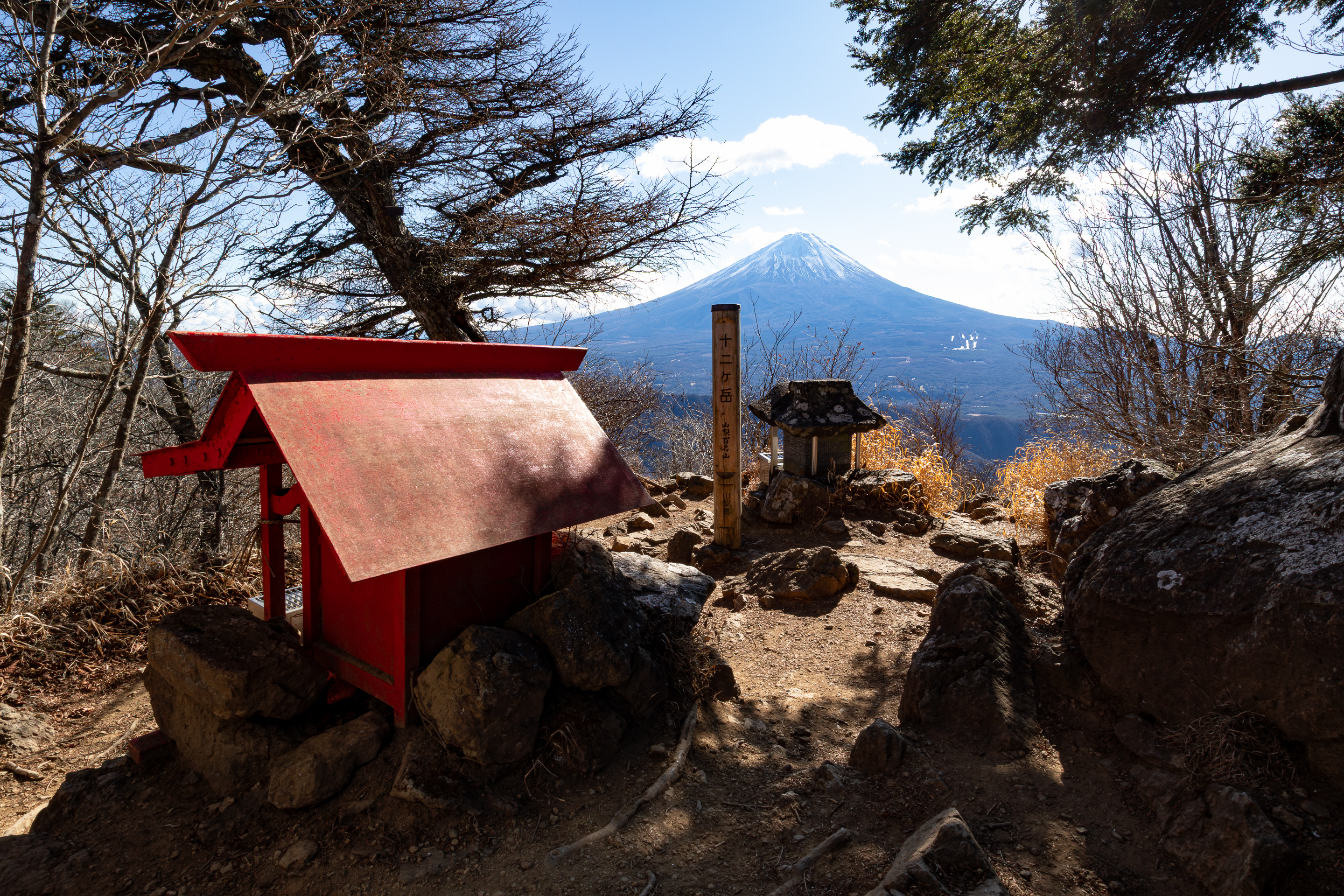
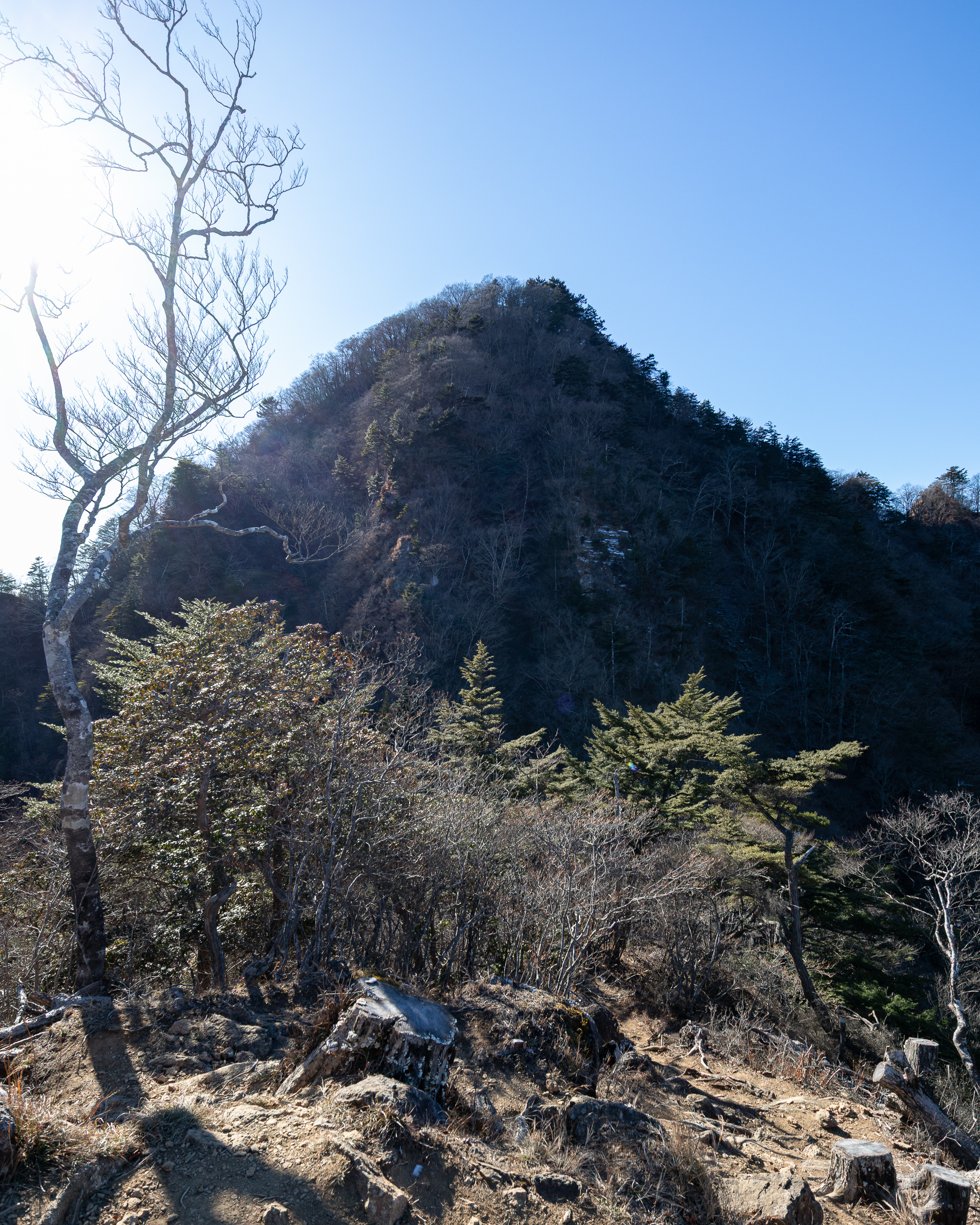
The hike up until Mt. Settogatake 節刀ヶ岳 was smooth sailing; zero troubles and the views were phenomenal. There were several viewpoints that allowed you to see both the south and north sides of the Misaka Mountains. On the south side we had Lake Kawaguchi, Fujikawaguchiko-machi, Fujiyoshida-shi, Lake Yamanaka, Mt. Fuji, Mt. Omuro, Aokigahara Forest, Lake Motosu, and the Tenshi Mountains. On the north side we had the Southern Alps, Kofu Basin, and the Yatsugatake Mountains. An impressive number of famous landmarks you could feast your eyes on.
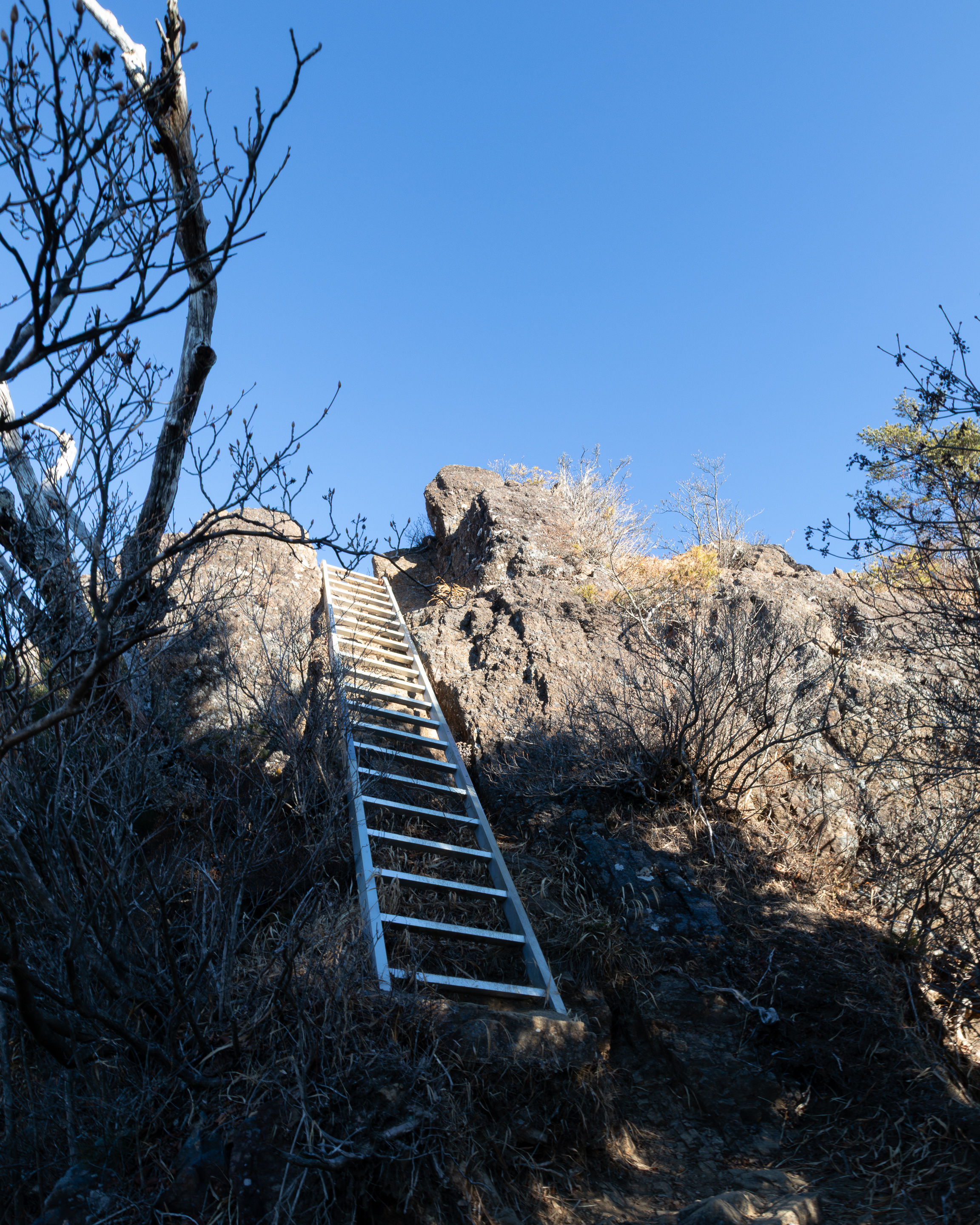
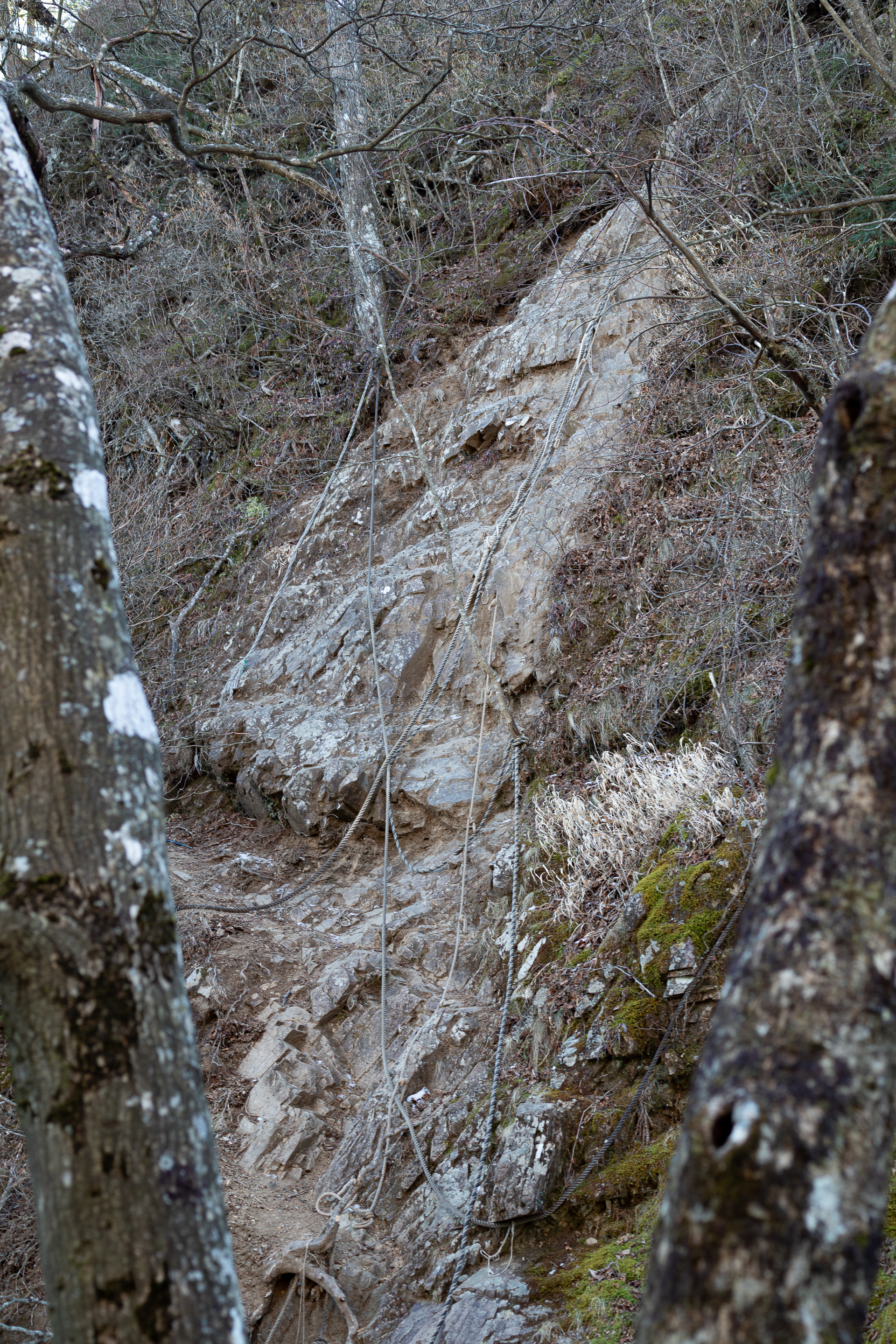
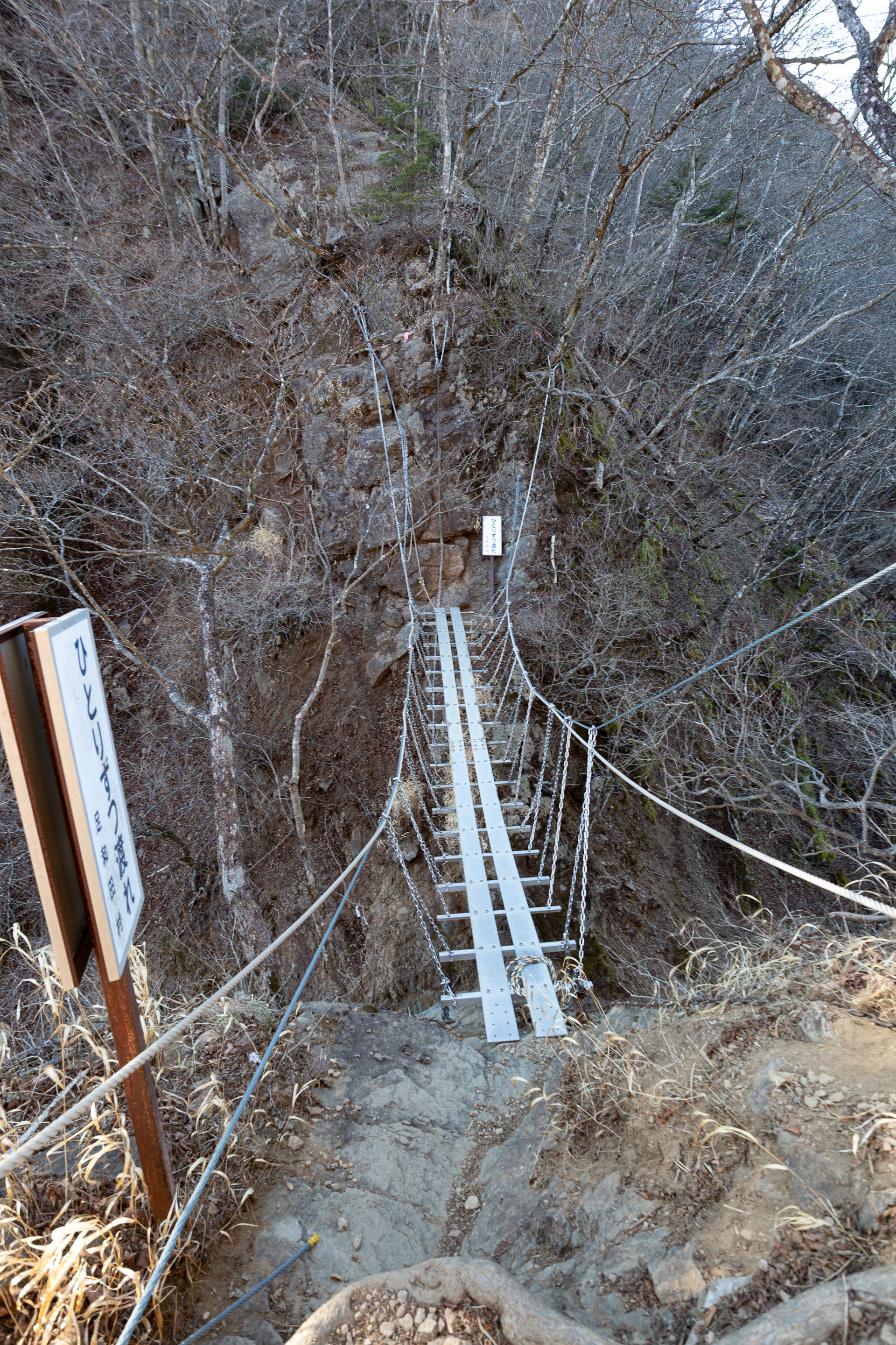
Things went downhill afterwards though. The trails to and from Mt. Junigatake were very treacherous. There were several rocky sections that were nearly 90° steep and approx. 6-9m high, with many ropes and chains. This area was where my backpack became a huge burden. My speed had come to a crawl. I had hiked roughly 20km up to this point, and it took me **three** hours to do the next 2km. The whole time I felt like I was squeezing out energy I didn't have, for hours on end. "Oh no, more ropes," "oh no, more rock walls"... It was incredible to pass a couple of elderly 60-plus-looking people, wondering how they managed such a feat. In my defense I was carrying 3kg worth of camera gear and had been climbing for 12 hours (I told myself).
Eventually I made it to the end (well, you can see this post). Apparently Mt. Junigatake was named so because there were 12 peaks, all the way to Ichigatake 一ヶ岳, just before Mt. Kenashi. My suffering did not stay on the mountains, though. My smartwatch ran out of battery (due to the longer-than-expected hike), so I couldn't use my virtual Suica and had to use cash. I missed the last train home and had to stay overnight at Otsuki Station, in sub-zero temperatures, waiting six hours for the first train. Butterfly effect be damned. At least now I have some cool pictures to look at, in exchange for all these self-inflicted ordeals.
P.S. The S24 Ultra seems to have poor flare handling. Also poor low-light video quality, but that's to be expected of smartphones. I wonder if recent large-sensor action cameras are any better.